Physical and Hydrological Characterization of Clark's Meadow
Title
Physical and Hydrological Characterization of Clark's Meadow
Abstract
This report summarizes the methods, results and conclusions of the investigatiocapabilities of meadow sediments. The partially restored nature of Clark's Meadow was used to determine the subsurface conditions and potential water storage offered a unique opportunity to observe the consequences of uncheck stream erosion in the lower half of the meadow against restored conditions in the northern half of the meadow. There were two phases to restoration on this stretch of Clarks Creek:
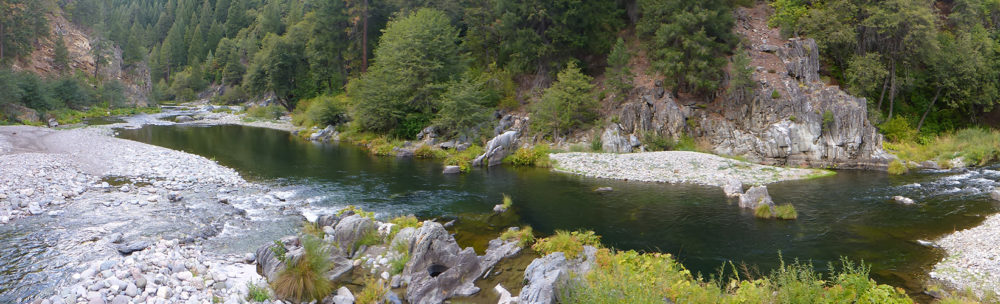
In 1992/94 a 2,000 foot stretch of channel on Clarks Creek, which flows into Indian Creek by way of Last Chance Creek, was stabilized using vegetation and rock placed to control erosion and improve fisheries and riparian habitat. International exchange and inner city minority students, California Department of Correction inmate crews, Janesville High School students, and the Milford Grazing Association volunteered labor for the project. Sponsored by the USFS as part of the Clarks 2000 plan and funded by the Student Conservation Association, PG&E, Department of Water Resources, and the California Department of Fish & Game for $24,000.
In 2001, a 4,300-foot gully on Clarks Creek (Plumas National Forest land) was eliminated using the 'pond and plug' technique, successfully restoring 50 acres of floodplain. The Forest Service grazing permittee, Doug Robbins, completed a new pasture fence. Not all of the project area was fenced in order to evaluate recovery of the site with and without grazing. Monitoring on Clarks Creek included thorough pre and post-project wildlife monitoring by Dave Bogener from DWR. Other continual monitoring includes groundwater wells, and aerial and ground photography. The project was funded by Prop. 204, and cost $90,000. Major partners were Plumas National Forest, Plumas County, Dept. Water Resources, permittee, Doug Robbins, the State Water Resources Control Board, and the Regional Water Quality Control Board.
Purpose
To reconnect the channel to its naturally evolved meadow floodplain in order to stabilize the channel, reduce erosion, and restore habitat.
To determine the water storage capabilities of eroded meadows versus restored meadows.
To determine the water storage capabilities of eroded meadows versus restored meadows.
Begin Date
2008-02-01
End Date
2015-08-21
Originator Name
Dr. Kevin Cornwell and Ms. Kamala Brown
Ordering Information
CSU Sacramento Geology Dept.
Links
www.feather-river-Coordinated Resource Management.org/images/stories/Publications/MountainMeadowReport2008.pdf
Supplemental Information
www.feather-river-Coordinated Resource Management.org/index.php?option=com_content&view=article&id=15&Itemid=14
Access Limitations
No Restrictions
Keywords
Erosion, Geomorphology, Groundwater, Habitat, Meadow, Meadow Restoration, Restoration, Restored Meadow, Stream, Water Storage
Limits on Use
No Restrictions
Progress
Complete
Resource Type
Document
Update Frequency
As Needed
Resource Owner
deercreekgisWebsite
To the owner of Physical and Hydrological Characterization of Clark's Meadow
1 file
- ClarksMeadow-HydroCharacterization.pdf 953.91 KB Added 20 Aug 2015